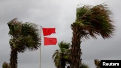
The U.S. National Hurricane Center says slow-moving Hurricane Sally, the latest storm to threaten the U.S. Gulf Coast, remains offshore but is already bringing high winds, rain and surf to the coastline.
In the latest report, forecasters say Sally was about 110 kilometers east to southeast of east of the coast of Louisiana and Mississippi. It currently has maximum sustained winds of 140 kilometers per hour, and hurricane warnings early Tuesday extended from the Louisiana-Mississippi border east to Florida.
Forecasters say Sally should reach land near the Alabama-Mississippi state line by late Tuesday or early Wednesday, although they stress “significant” uncertainty as to where the storm’s eye would make landfall. But they say Sally is moving more eastward than originally anticipated, sparing the city of New Orleans.
The slow-moving system is expected to produce 25-50 centimeters of rain, but isolated areas could see as much 76 centimeters. That, along with storm surge that could be almost three meters in the worst areas, has increased the likelihood of coastal flooding in the warning region.
Florida Gov. Ron DeSantis declared an emergency in the state’s western Panhandle’s areas, which were experiencing a great deal of rain Tuesday from the storm.
President Donald Trump issued emergency declarations Monday for parts of Louisiana, Mississippi and Alabama, and he tweeted that residents should listen to state and local leaders.
Alabama Gov. Kay Ivey sought the presidential declaration after the National Weather Service in Mobile, Alabama, warned of the increasing likelihood of “dangerous and potentially historic flooding,” with waters rising as much as 9 feet (2.7 meters) above ground in parts of the Mobile metro area. Ivey urged residents Tuesday to stay vigilant and heed any emergency warnings.


