The Associated Press contributed to this report.
The National Hurricane Center said Sunday that Tropical Storm Barry is gradually weakening as it moves across western Louisiana with maximum sustained winds of 65 kilometers per hour.
Barry's primary threat is "dangerous, life-threatening flooding," according to the hurricane agency, but the storm is expected to weaken to a tropical depression later Sunday. Even so, the agency said tornadoes are possible in the storm's path northward away from the Gulf of Mexico.
Barry is expected to douse south central Louisiana with 15 to 30 centimeters of rain with some areas receiving as much as 38 centimeters.
The Lower Mississippi Valley is predicted to receive 10 to 20 centimeters of rain with isolated maximum amounts of up to 30 centimeters.
The storm made landfall Saturday in Louisiana near Intracoastal City, according to the National Hurricane Center, which warned that Barry is likely to bring dangerous storm surges, plus strong wind and heavy rain in parts of the Gulf Coast and the Lower Mississippi Valley.
On Saturday night, Gov. John Bel Edwards urged residents across south Louisiana to stay “vigilant,” warning that Barry could still cause disastrous flooding across a wide stretch of the Gulf Coast overnight.
“This storm still has a long way to go before it leaves this state,” Edwards said. “Don’t let your guard down.”
The storm, the first Atlantic hurricane of the season, was briefly a Category 1 hurricane. By late Saturday night, its maximum sustained winds had fallen to 50 mph (80 kph).
National Hurricane Center Director Ken Graham said Barry has collected “a big slug of moisture” and is expected to rain on the region throughout the weekend.
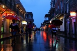
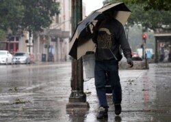
Residents in New Orleans fortified their homes and stocked up on supplies as Barry began to roll in from the Gulf of Mexico. However, by late Saturday night, the city had been spared the worst of the storm, receiving only light showers and gusting winds.
By early Sunday, forecasters had downgraded rainfall estimates for New Orleans through the day to between 2 to 4 inches (5 to 10 centimeters). Forecasters earlier said New Orleans could get up to 20 inches (50 centimeters) of rain.
City officials have advised residents to shelter in their homes, with the exception of two coastal parishes south of the city, where mandatory evacuations were ordered.
Two parishes harder hit
No levees along the Mississippi River failed or were breached, but two levees were overtopped in Terrebonne and Plaquemines parishes.
Officials said an estimated 400 people were ordered evacuated in Terrebonne Parish, which is about 100 kilometers (62 miles) southwest of New Orleans. The Coast Guard also rescued a dozen people from flooded areas in the parish. Some had sought refuge on rooftops, a parish spokeswoman said.
Late Saturday night, authorities were trying to rescue a family of five trapped by high water in the south Louisiana town of Franklin, according to KTBS-TV. The National Guard had to halt its initial rescue mission because waters were too high to safely reach the family’s home. Franklin is about 40 miles (64 kilometers) southeast of Lafayette.
In other parts of Louisiana on Saturday, Barry flooded highways, forced people to scramble to rooftops and dumped heavy rain. Downpours also lashed coastal Alabama and Mississippi.
Tourists had largely left New Orleans Friday. Some airlines canceled outbound flights Saturday.
The storm is widely seen as a test of the city’s weather defenses put in place following Hurricane Katrina in 2005, which left about 1,800 people dead.
U.S. President Donald Trump declared a state of emergency in Louisiana Thursday night, authorizing the Department of Homeland Security (DHS) and the Federal Emergency Management Agency (FEMA) to coordinate federal funds and resources to help the state cope with the storm and its aftermath.
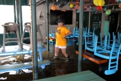
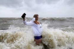
In Mandeville, a city on the north shore of Lake Pontchartrain across from New Orleans, storm surge and choppy waters sent waves over the seawall and into nearby communities. Dozens of people waded through knee-high water to take a look at the pounding surf.


