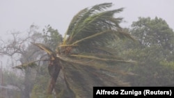
Record-breaking Cyclone Freddy made its second landfall in Mozambique on Saturday night, pounding the southern African nation with heavy rains and disrupting transport and telecommunications services.
French weather agency Météo-France warned of “destructive and devastating” winds and “dangerous seas and heavy rains" that could lead to landslides. It said Freddy will go further inland through the weekend, generating heavy rains in Mozambique and southern Malawi, with rain also likely in Zimbabwe and Zambia.
It's the second time Freddy has hit the country, with the cyclone originally making landfall late last month.
Météo-France also raised concerns that Freddy is unlikely to weaken over land in the coming week and has a high probability of exiting back into the sea. Freddy made landfall with maximum wind speeds at sea measuring 155 kilometers an hour and sea gusts averaging 220 kilometers an hour, the agency said.
Freddy was initially on course to make landfall in the country Friday night but stalled over the Mozambique channel. The cyclone then intensified on Saturday and regained strength as it barreled toward land, Mozambique’s National Institute of Meteorology said.
The cyclone’s second punch was showering a low-lying, vast land teeming with rivers and “almost all of them have no dam” to ease flooding, said Salomao Bandeira, a scientist at Mozambique’s Universidade Eduardo Mondlane. Flooding in the country earlier this year slammed regions where major rivers are controlled by dams, allowing some degree of control, Bandeira said, raising fears this hit could lead to more destruction.
The projected deluge is already worrying health and disaster agencies in both Mozambique and Malawi, who have recently been battling cholera cases and other water-borne ailments. The U.N. and EU-led disaster alert system has already issued a red alert projecting that some 2.3 million people will be impacted. Mozambique’s disaster institute has moved thousands of people to storm shelters in anticipation.
“More lives are being saved in Mozambique today” due to early preparedness, Bandeira said.
In a statement released Saturday, Malawi Red Cross said it had activated its early response teams in southern Malawi to prepare for the cyclone.
Earlier in the week, Freddy’s longevity and baffling trajectories caused the U.N. weather agency to set up a committee to determine whether it has broken the record as the longest-lasting tropical cyclone in recorded history after traversing more than 8,000 kilometers in the southern Indian Ocean.
The U.S. National Oceanic and Atmospheric Administration said Freddy has already catapulted into the record books for the second-ever highest accumulated cyclone energy, or ACE, a measurement of a cyclone’s energy over time.
Freddy is also the third storm on record to last more than 22 days, said NOAA's Carl Schreck. Hurricane John in 1994 and an unnamed Atlantic hurricane in 1899 are the other two. The natural weather event La Nina and a negative Indian Ocean Dipole, or a change of temperatures over the ocean, "may have produced ocean temperatures and atmospheric circulations that made an event like this more likely,” Schreck added.
Any storm that can remain at such a “strong intensity for so long and make two landfalls is important in terms of human impacts and in terms of science," said Kristen Corbosiero, professor of atmospheric and environmental sciences at the University of Albany.
“Intense storms generally go through a series of eyewall replacement cycles and intensity fluctuations,” where the cyclone begins to develop a a new eye, Corbosiero said. "But Freddy didn’t have these cycles for most of its life cycle. Trying to understand why, will be a good research topic.”


