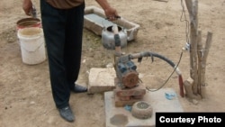
About 140 million people around the world drink water contaminated with unsafe-levels of arsenic.
The element is found naturally in rocks and soil, but exposure to it presents a major public health problem, especially in regions where untreated groundwater is the only reliable source of drinking water.Scientists have deployed a new statistical tool that can help predict the greatest risk of contamination.
Luis Rodriguez-Lado led the team that designed the method. The soil scientist from University of Santiago de Compostela says the model was tested in China, where in 1994 the Chinese government declared arsenic poisoning an endemic disease.
Officials responded with an initiative to test all wells in the country. Rodriguez-Lado says the effort is so massive that it could take decades to complete. He says his model can help speed that up, while it complements traditional testing methods.
“Our model provides a quick overview of the areas potentially at risk," he said. "So it can be used to optimize the screening efforts at full scale and prioritize the analysis of the areas potentially at high risk, saving money and time."
That model, described in the journal Science, identifies Chinese arsenic hot spots based on factors thought to be predictors of high levels of the chemical element, like soil moisture, salinity and topography.
In a companion piece in the same journal, University of Delaware geologist Holly Michael says the scientists also combined their probability maps with population data to estimate the scope of potential problems.
“This is valuable because it uses easily accessible data, data you can see on land surface and that in some cases can be detected remotely, say from the sky," she said. "Their analysis then allows them to take this information and then identify areas that are at risk of having high arsenic in the subsurface, in their drinking water."
That analysis shows that 19.5 million Chinese live in high-risk areas. Michael says the model also identified regions not previously thought to be at risk, like the central part of Sichuan province.
"And if you look at the maps that they produce, you will see that not all areas have high risk. So it is valuable to be able to identify those high risk areas and then make sure that as many wells as possible in those areas are tested," she said.
Lead author Rodriguez-Lado says the method used in China is not limited to China or arsenic. He calls it a promising technique for risk maps for any kind of pollutant.
“We believe that in the coming years environmental modeling will be generalized and used for many pollutants and even more efficient than it is today," he said.
Rodriguez-Lado says he hopes his team’s work can be used to support well monitoring programs currently in place and promote others.
“This kind of study,” he says, “can help improve health for millions of people, especially in developing countries.”


