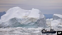
U.S. researchers say the first measurements of the Earth’s melting land ice using NASA satellite data shows the shrinking ice caps and glaciers led to a 12 millimeter increase in global sea levels from 2003 to 2010.
The scientists from the University of Colorado at Boulder made their calculations with data collected by the U.S. space agency’s twin GRACE satellites. They say the results indicate the Earth has lost more than 4.3 trillion tons of land ice from Greenland, Antarctica, and the ice caps during the seven year period covered in the study.
The scientists say the new findings will help answer important questions about rising sea levels, as well as how the Earth’s cold regions are responding to global climate changes.
The University of Colorado researchers say the advantage of using the satellites’ measurements is they see all the mass in the glacier and ice cap system. Traditional estimates were made using ground measurements from only a small fraction of the planet's total land ice area.
The new University of Colorado at Boulder-led study is published in the journal, Nature.
NASA Satellite Data Helps Scientists Measure Earth's Melting Land Ice


