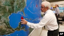
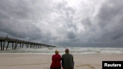
Hurricane Michael is getting stronger as it barrels through the Gulf of Mexico, and forecasters say it could approach Category 4 status before it slams into the Florida Panhandle.
As of late Tuesday, Michael was a Category 3 storm located about 400 kilometers south of Panama City.
Michael's top sustained winds were 195 kilometers per hour. But the storm is gaining energy from the warm Gulf waters and forecasters said it could be close to a Category 4 when it makes landfall around midday Wednesday.
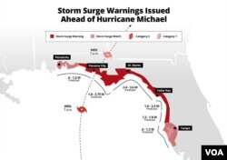
Hurricane warnings have been issued for the Alabama-Florida border eastward. Tornadoes and as much as 30 centimeters of rain are expected in some areas.
Florida Governor Rick Scott is calling Michael a "monstrous hurricane," warning that it could bring "total devastation" to parts of the state. He is urging residents not to ignore evacuation orders and to pay close attention to news reports.
Forecasters were warning the Panhandle and Big Bend areas could see storm surges of 2.5 to 4 meters.
President Donald Trump said federal emergency officials are standing by.
The National Hurricane Center said Michael is the first major storm to hit the Florida Panhandle since Hurricane Dennis in 2005.
Hurricane Michael is a fast-moving storm that forecasters said will quickly weaken as it moves across land. The storm will drift into the Mid-Atlantic States and out to sea by Friday.
Michael will strike the U.S. after having soaked parts of Central America and Cuba with heavy rains, causing flooding and knocking out power.
At least 13 storm-related deaths have been reported in El Salvador, Honduras and Nicaragua.


