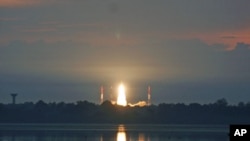
India has successfully launched a satellite that experts say will dramatically boost the country's ability to view detailed images of the earth.
Indian Prime Minister Manmohan Singh congratulated Indian aerospace engineers Thursday after a rocket successfully lifted an advanced imaging satellite weighing nearly 2,000 kilograms into orbit.
K. Radhakrishnan, chairman of the Indian Space Research Organization, describes the launch as a victory for India.
"Our initial data shows we have achieved an orbit with 470 to 480 kilometers," said Radhakrishnan.
The satellite is called RISAT-1, which stands for "radar imaging satellite." Unlike previous imaging satellites launched by India, which collect a picture of the ground using optical cameras, RISAT 1 bounces microwave signals off the Earth.
Dr. Ajay Lele, a researcher at New Delhi's Institute for Defense Studies and Analyses, says the satellite sensor will be able to obtain clear images no matter what is happening below.
"This sensor gives you an opportunity to see towards the earth in all sorts of weather conditions, and night time and morning time and day time hardly has got any impact as far as the sensor is concerned," said Lele.
Such all-weather capability is significant in India, which experiences an annual monsoon season during which heavy cloud cover can impair the usefulness of optical satellite imagery.
"Previously we used to have only the cloud picture, just image alone. This gives additional parameters. All will be used for our weather forecast for the coming years," said T. K. Alex, director at the Indian Space Research Organization.
In addition to images, RISAT-1 is capable of gathering data on cloud temperature, cloud speed, and the level of air humidity.
Lele, with the Institute for Defense Studies, said the satellite will have various uses for the Indian government.
"It has got relevance for climate change, disaster management, flood relief, agriculture, too. It will have a certain amount of relevance in the strategic sector, too, because it will allow us to monitor the troop movements or infiltration, terrorist organizations, which are operating from deeply forested areas, and other stuff," said Lele.
RISAT-1 has an expected mission life of five years, making 14 orbits a day. The launch is likely to create economic benefits for India, generating interest among other nations who seek data or technological assistance, or want to commission India to launch a satellite on their behalf.
News
India Successfully Launches 'All-Weather' Surveillance Satellite
- By Kurt Achin


