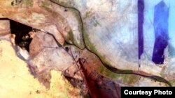
Sometimes we get a clearer perspective by taking a step back. A new project by Google, the U.S. Geological Survey (USGS), NASA and TIME offers the distance we need to see our planet, and our species, like we’ve never seen them before.
The project, called Earth Engine, is made up of more than 28 years of satellite images taken of Earth and turned into an interactive timelapse map that shows expanding cities, shrinking rainforests, drying lakes and melting glaciers.
Dubai, 1984 - 2012. Landsat imagery via Google.
The U.S. space agency, NASA, tweaked its observation of the universe in the 1970s so that it wasn’t just looking into outer space, but was also peering down at Earth, watching how humans are altering the planet we live on. The mission, called Landsat, has collected millions of images with eight orbiting satellites, all archived by the USGS.
Those images weren’t doing the public much good until the U.S. government decided in 2008 that they should be available for free to anyone who wanted to use them. That’s when the Internet giant, Google, stepped in.
In 2009, Google started sifting through 2,068,467 images - 909 terabytes of data - to find the best-quality pictures taken between 1984 and 2012. Throwing out pixels shrouded in clouds or forest fire smoke or industrial smog, Google brought their pictures to Carnegie Mellon University’s CREATE Lab to produce an online animation.
The result is a revelation, sometimes frightening, sometimes breathtaking.
Brazil's Amazon rainforest, 1984 - 2012. Landsat imagery via Google.
The deep green of Brazil’s Amazon rainforest fades into a brownish landscape scarred by deforestation. The straight razor edge of Dubai’s desert coastline sprouts artificial islands, made into the shape of palm trees by sand dredged from the ocean floor. And images of the Columbia Glacier in the U.S. state of Alaska begin as a blinding white blanket in 1984 and end, 28 years later, as shredded patches of snow.
From Hong Kong to the Democratic Republic of Congo to your home town, Earth Engine offers a new perspective, wherever you are. The self-guided tour through man’s “development” on Earth is both inspiring and troubling with its unvarnished look at where we’ve been and where we’re going.


